Environmental Analysis Experience Within GIS
Watershed Analysis
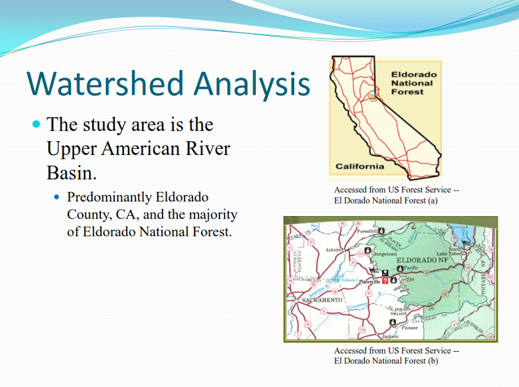
I used ArcMap to delineate the water budget and flow tendancies of a watershed in Eldorado County, California. Click on the report's cover page to open the report.
River Contamination Analysis
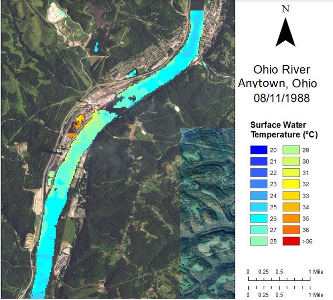
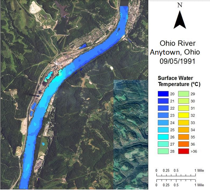
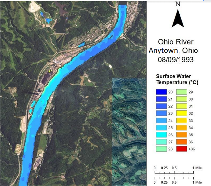
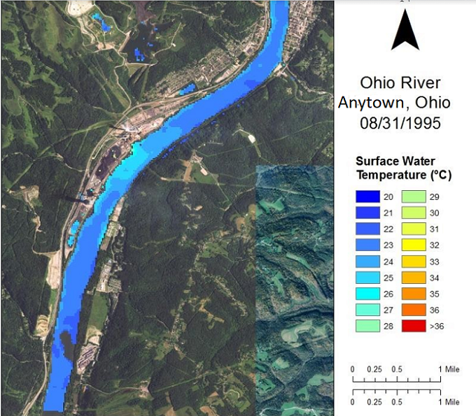
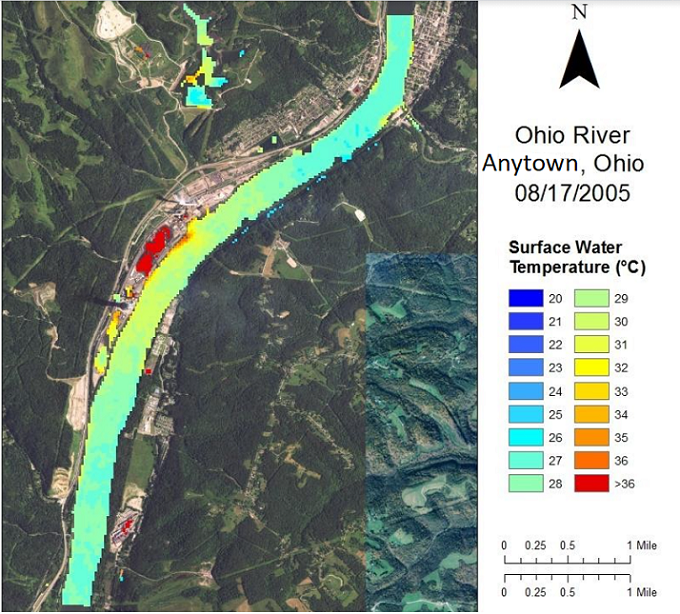
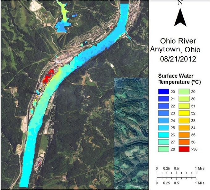
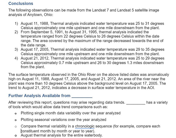
The screenshots below are taken from a report of contamination detection from Landsat 5 and 7 data in the Ohio River. The conclusion is a summary of the findings and project proposal.
Website Design by Doug Wolfinger. © 2021 Doug Wolfinger